One of Mongabay Latam’s key achievements has been the use of innovative tools to fill huge gaps in official and public information about Latin America’s environment. Over the past few years, the team has built 20-plus databases containing critical information on mining, drug trafficking, fines imposed on fossil fuel and palm oil companies, cases of environmental defender killings that have gone unpunished or that have been prosecuted, geolocated environmental liabilities like contaminated sites left behind by the oil industry, and more.
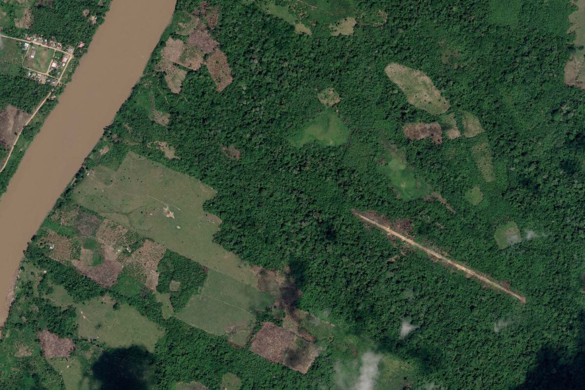
The quality of this reporting and use of data continues to have real-world impact, as the findings have been used to inform judicial and police action. For instance, a series of data-driven stories in 2021 analyzed more than 724,000 Global Forest Watch deforestation alerts and satellite data to document illegal deforestation of Indigenous lands in Colombia, Bolivia, Peru and Ecuador. This resulted in a special series called “Crime maps” that showed how illegal actors are increasingly dominating forests, and which identified formerly unknown cases where local communities are being threatened by drug traffickers, rebel groups, land grabbers, and loggers with little or no attention from the media. This effort contributed to legal action in Peru where the Attorney General of the Ministry of the Environment, Julio Gúzman, shared information resulting from a Mongabay article with the Specialized Environmental Prosecutor’s Office to open an investigation for deforestation prevention.
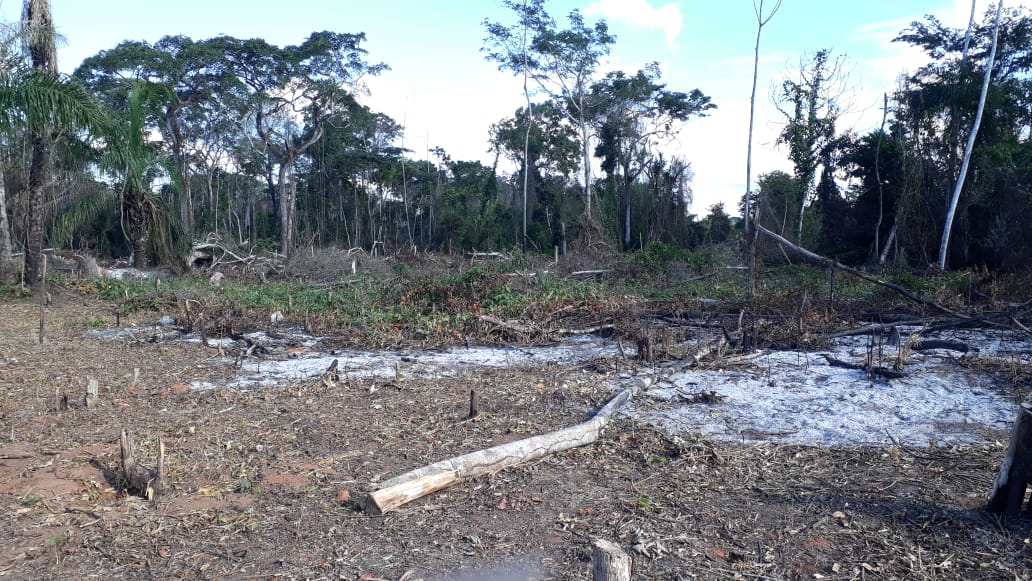
Deforestation in Bajo Paraguá. Image courtesy of the Mayor’s Office of San Ignacio de Velasco.
We are nonprofit.
Help us tell stories of biodiversity loss, climate change & socio-environmental injustice.
Mongabay Latam’s most recent investigative series conducted in partnership with Earth Genome (also published in English), used an artificial intelligence tool to locate 67 clandestine airstrips used for drug trafficking in three Peruvian regions. The original reporting confirmed these runways’ location, size, use, date of opening, as well as proximity to roads and rivers. Among the airstrips discovered, 30 were located in Indigenous communities and 26 in their surroundings. Three other airstrips were identified in two Indigenous reserves, and 10 more inside forest concessions. In relation to these, it was revealed that at least 15 Indigenous leaders have been killed and 28 are under threat. The tool also opened a new field of research in the Amazon that helps officials understand the complexity of organized crime in these areas and its impact on vulnerable populations and fragile ecosystems.
Within weeks of publication, the “Amazon Airstrips” series garnered much attention from decision-makers and experts from civil society. For example, Congresswoman Ruth Luque, who chairs the Committee on Andean Amazonian Afro-Peruvian Peoples, Environment and Ecology of the Peruvian Parliament, commented on the investigation via social media: “The insecurity that the country is experiencing requires that the centralized and urban approach be abandoned; a comprehensive approach is needed that makes visible the threats faced by indigenous peoples, who today are confronted with a growing illegal economy and absolute defenselessness against drug trafficking, in whose territories the action and presence of the State is non-existent. The report presents alarming data.”
Former Prime Minister Alberto Otárol also shared this on social media: “Very interesting work. Law 30339 allows the control, surveillance and defense of the national airspace. It must be drastically applied to confront lethal narco-flights.” Many media outlets also reached out to Mongabay Latam requesting interviews and further information, and dozens of news providers republished or used the findings in their own reporting on the topic.
The Asociación Interétnica de Desarrollo de la Selva Peruana (AIDESEP) – a Peruvian Indigenous rights organization that acts as the political representative of the nation’s native communities – also used the investigation to demand that the Ministry of Culture provide information on what was being done to prevent drug traffickers from attacking people in Indigenous territories, and Indigenous people living in isolation and initial contact (PIACI).
Coca leaf plantations leave little profit to settler and Indigenous families. The real business is in the other links of the drug chain that transform it into paste and cocaine. Image by Mongabay Latam.
Beyond revealing overall trends of increased criminality and threats of violence against local communities, the use of forest monitoring data can also help sustain coverage where it would otherwise be impossible, says Mongabay Latam Program Director MariaIsabel Torres: “Sometimes we can’t go to an area because it is too dangerous [or] we have to come back early because Indigenous leaders tell us that drug traffickers are there. So, satellite data have become key for almost every story we do. We have developed a completely different set of skills. In Peru we started geo-referencing all the Indigenous communities, then we added layers of maps on deforestation, illegal mining operations, illegal crops, and on airstrips the authorities already knew about. And suddenly you get an idea of the magnitude! In Peru, we found that more than 60% of the Indigenous communities were surrounded by different kinds of forest crime. We then share that information with local communities. We also mapped oil concessions in four Amazonian countries on top of Indigenous communities and found that, in some cases, 100% of a community’s territory is explored by the government for oil concessions, and local people had no idea!”
In 2024 alone, Mongabay journalists were invited on several occasions by Colombian, Paraguayan, and Panamanian congressional members to present their findings on the magnitude of crimes such as the shark fin trade, the expansion of illegal economies, the advance of deforestation caused by the Mennonite communities, or the lack of policies to deal with the region’s first climate-displaced people. Mongabay also actively shares its work with local partners and journalists who often lack the time or resources for the arduous groundwork that’s needed to initiate investigations.
In this way, Mongabay Latam often acts as a catalyst and bridge to many regional media outlets, engaging specialists such as geographers to help with building maps and graphics, and assisting with final editing. As Torres says, “It has been a very productive methodology to have these co-operations because it makes their coverage of the field more in-depth. Local journalists know their territory, the most important leaders to be in touch with, and the dangers they could face. And we have done a lot to understand these problems from a regional point of view.”
If you are interested in helping shed light on conservation issues such as this, there are two excellent ways you can do so with Mongabay. First, consider making a donation, which directly helps us continue to produce high-impact journalism from nature’s frontline. Second, subscribe to Mongabay’s newsletter to get the latest environmental news delivered right to your inbox, and share whatever articles move you with friends and family.
About Mongabay
Mongabay is a nonprofit environmental science and conservation news platform focused on providing original, reliable, and independent journalism from nature’s frontline. We pride ourselves on producing reporting that has substantial and tangible impacts around the world.
Stay updated
Delivering news and inspiration from nature’s frontline.